I see Smeagol behind every rock


our view of Mt Ngauruhoe aka MT DOOM
preparing to hike into nothingness
ouch. sliding through "loose scree" into the red crater
David and Jacob agree that it's time to eat more chipies

the scenery becomes a lot more grassy. i imagine Legolas trotting lightly down the hill on his little elf feet

taking a rest before our descent

pretty high up, its gonna be a long walk down

and then suddenly we are in the jungle. its a nice shady walk till the end of the trail
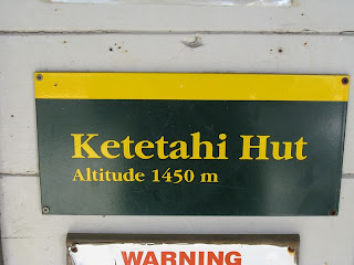
So here's a quick summary of the Tongariro Alpine Crossing. We started at the Mangatepopo car park where our bus dropped us off, and started the first part of our trek to Soda Springs. This part was pretty easy and we got a great view of the surrounding mountains towering above us as well as a waterfall and some small creeks which I assume are the Soda Springs. The next part of the hike becomes a lot steeper as we hike up the side of the South Crater. This section was called the Devil's Staircase. Once we have conquered the Devil's Staircase we make our way across the flat South Crater. Once to the other side of the crater we have lunch on a small rock outcropping overlooking a steep rocky cliff marking the rim of the crater where "if you fall you will not come out" (according to our map). At this point we might have been able to take the side track up Mt Ngauruhoe, but we were afraid we would not have enough time to catch the bus if we did. Next we begin our "last big climb for the day" up the Red Crater Ridge. For me this was the hardest part of the trek because it was extremely steep and the ground was quite loose under our feet. Once we reached the top we had a view of the Emerald Lakes down below in the crater. This spot was incredibly beautiful as well as pretty strange. After we passed the Emerald Lakes we soon came across the Blue Lake which was much larger and didn't look as though if you jumped into it you would sizzle into a crisp. We then followed the track down through the Rotopaunga valley to the Ketetahi hut where there were toilets and a nice spot to rest for a bit. Coming out on this side of the pass there was a dramatic change in scenery. The view was a lot less alien and volcanic, and more open and picturesque. Im not sure which I prefer. The hike down the north face of the mountain was really a downhill stroll through pretty hills and flowers. Then, yet again the scenery changed and we entered into a tunnel of trees. The last mile or so of the trip was through a ferny forest complete with picturesque waterfalls a loud birds. It really was a strange journey and I definitely felt accomplished by the end.


5 comments:
ahhh i love your pictures the emerald lakes are incredible! i miss you love you, how are your maori (sp?) culture classes?
Wow. I wish i could have been there. If we ever go back as a family You need to show me that area. Did It look something like this?
http://www.tuckborough.net/images/rohan.JPG
Oh well, See you later Jill
-Miller
Totally Cool! I think I would do better with the hike than the Bungy jumping! Miss you and love you! PS. Emma and I went to the Visionary Art Museum Saturday and saw some really interesting bottlecap sculptures - we both thought of you!
Blkae thought this was your best trip yet. He wanted a rock from Mt Doom but I told him it was to late. Have fun!
Blake ad Russ
Hi Jillian,
Loved your posts! Especially the Tongariro one. I read it before I did it few weeks ago under sub zero conditions - still in December!. Yes I enjoyed as you did too and hopefully will do the South Island road trip as well. Hope you enjoyed your stay here and now well settled in your life. And hope you will one day come back and enjoy this beautiful land once more!
Cheers
LalP
Post a Comment